

Region
The Ecuadorian Andes
Humboldt called it the Avenue of the Volcanoes and the name stuck for two centuries. It is still the best road in South America.
Short answer
The Ecuadorian Andes are a 300 km corridor between two volcanic ranges that Humboldt named the Avenue of the Volcanoes in 1802. Inside it sit Quito’s UNESCO old town at 2,850 m, Cotopaxi, the turquoise Quilotoa crater at 3,900 m, the market town of Otavalo, the waterfall town of Baños, and Cuenca. Five to eight days covers it. The real hazard is not crime — it is altitude, and it is solved by the order of the days.
Quick facts
- Also called
- The Avenue of the Volcanoes — named by Alexander von Humboldt in 1802
- Quito
- 2,850 m · first UNESCO World Heritage city, 1978
- Cuenca
- 2,560 m · UNESCO World Heritage, 1999 · our office
- Highest point on the circuit
- Cotopaxi refuge, 4,864 m
- Driest months
- June–September and December–January
- Days needed
- 5–8
Quito: the old town is the point
Quito's colonial centre was inscribed on the very first UNESCO World Heritage list in 1978, alongside the Galápagos — the two of them were among the twelve sites that started the list. It is the largest and best-preserved historic centre in the Americas, and it is a working city centre rather than a preserved one.
Give it a full day: La Compañía, whose interior is covered in gold leaf; the Basílica del Voto Nacional, whose gargoyles are Ecuadorian wildlife instead of monsters; and the walk up to El Panecillo — which you take a vehicle to, not on foot, for reasons covered in the safety briefing.
Cotopaxi: the drive is the experience
At 5,897 m Cotopaxi is one of the world's highest active volcanoes and, on a clear morning, one of the most perfectly symmetrical. Most visitors drive into the national park, walk the Limpiopungo lagoon at 3,800 m, and then climb the sand slope from the car park to the José Ribas refuge at 4,864 m. That climb is under a kilometre in distance and takes most people 45 minutes to an hour, because of the altitude.
This is the single most common itinerary mistake in Ecuador. Landing in Quito at 2,850 m and standing at 4,864 m thirty-six hours later is how people spend the rest of the week unwell. Give it day four or five.
Quilotoa: a crater full of turquoise
A 3 km-wide caldera at 3,900 m, filled with mineral-coloured water that changes shade with the light. You can look at it from the rim in ten minutes, walk down to the shore in thirty, and climb back up in sixty to ninety — that climb is the hardest thirty minutes on most Ecuador itineraries, and there are mules for hire at the bottom for a reason.
The Quilotoa Loop proper is a multi-day village-to-village walk through Chugchilán, Isinliví and Sigchos. It is superb and it is not for everyone; we build it as a standalone trek rather than bolting it onto a general tour.
Otavalo, Baños and Cuenca
Otavalo holds the largest indigenous market in South America. Saturday is the real one — the town disappears under it, and the animal market on the northern edge starts before dawn. The Otavaleño textile tradition predates the Inca conquest of the region.
Baños de Agua Santa sits at 1,800 m on the eastern slope, which makes it both Ecuador's adventure-sports town and a genuine altitude reset in the middle of a highland itinerary. Waterfall route, thermal springs, canyoning, and the Pailón del Diablo.
Cuenca, UNESCO-listed since 1999, is the most beautiful colonial city in the country and the one most visitors skip because it is four hours south of the standard loop. It is also where our office is, which we mention only because it means our knowledge of the southern highlands is not second-hand.
How we sequence a highland trip
- Day 1 — arrive, do nothing. Quito, 2,850 m, an easy afternoon.
- Days 2–3 — Quito and Otavalo. Moderate altitude, full days, no exertion above 3,200 m.
- Days 4–5 — Cotopaxi and Quilotoa. The high days, once you are acclimatised.
- Days 6–7 — descend to Baños. 1,800 m. Everyone sleeps better.
- Day 8 — out, or continue to the Amazon, which is downhill from here.
The summit above you is the farthest point on the planet from the centre of the Earth — farther than Everest. Why that is true, and twenty-nine other verified facts →
Photographs
The Andes, photographed on our own trips
No stock library. These are our own operational photographs, and if we do not have a real one of something, we do not put a picture of it.
-
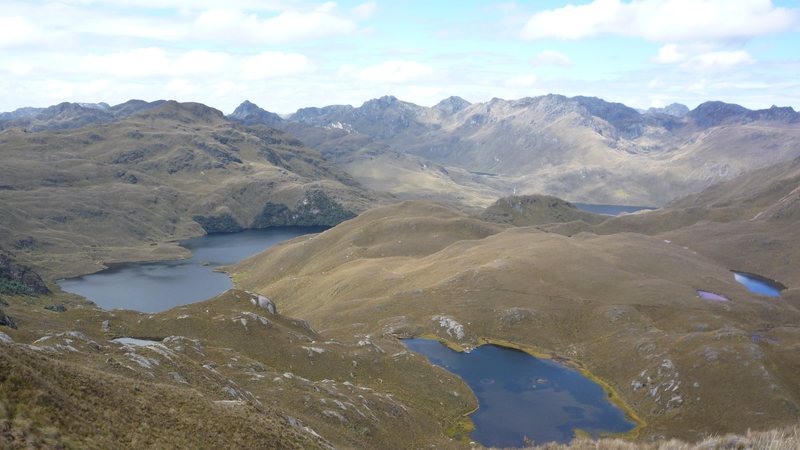
The páramo lakes of Cajas National Park Azuay, above 4,000 m -
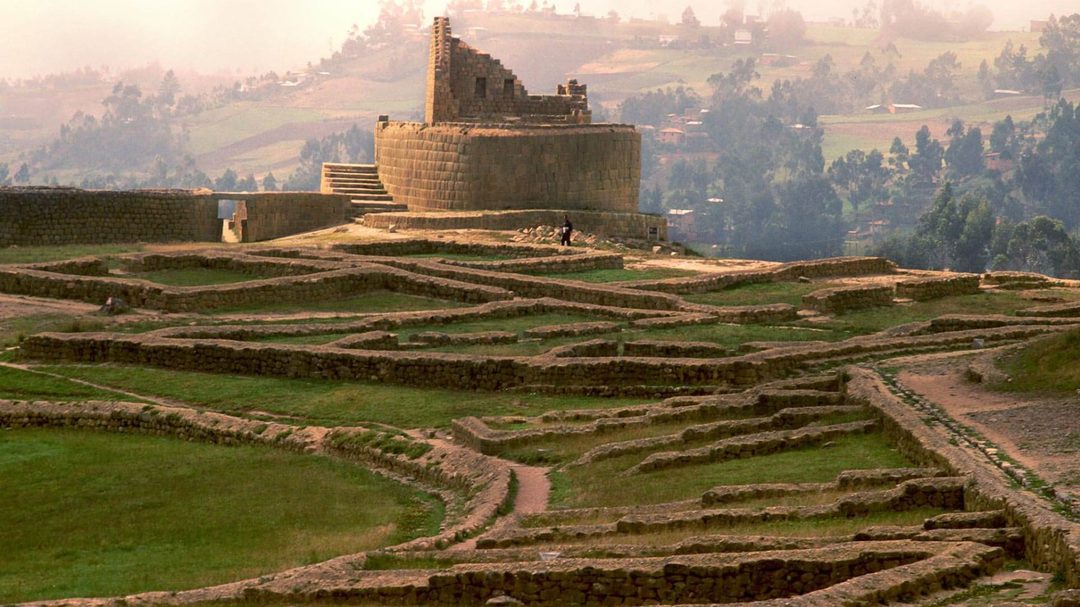
Ingapirca, the largest Inca site in Ecuador Cañar -
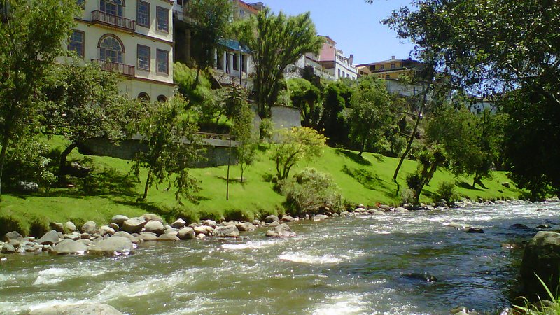
The Tomebamba and the hanging houses Cuenca -
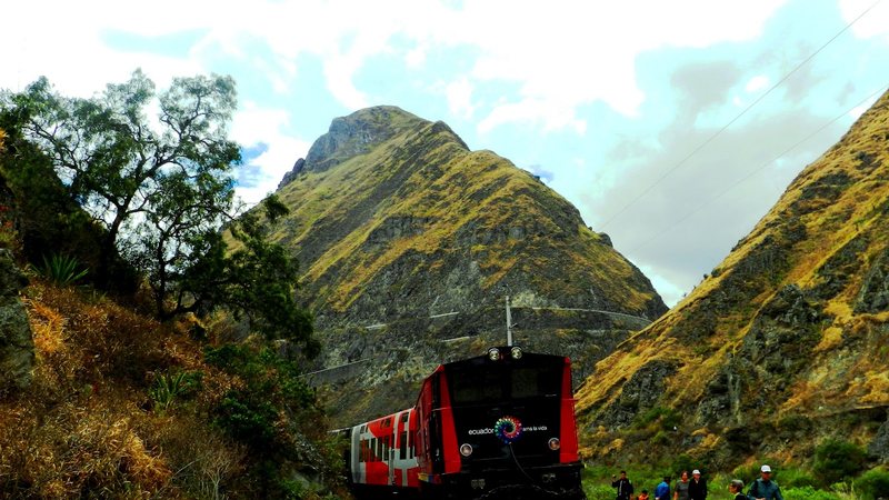
The Devil’s Nose train on the switchbacks Alausí, Chimborazo -
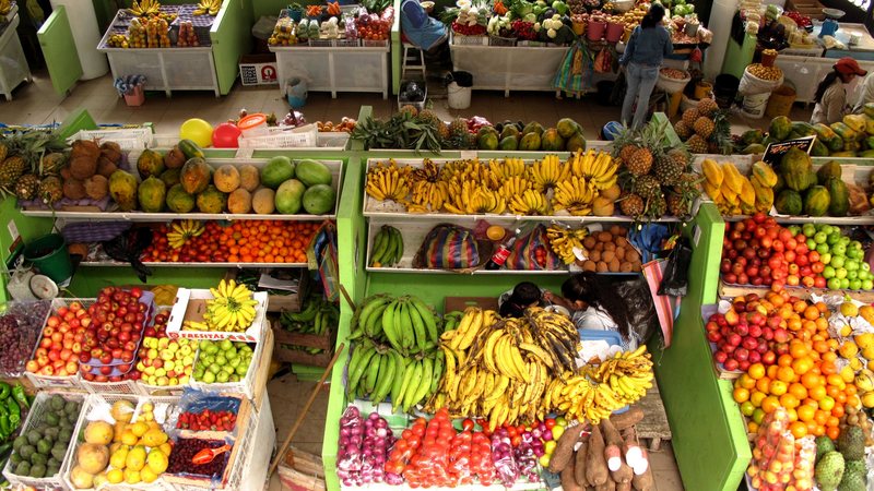
A highland market stall, mid-morning Southern Andes


Straight answers
The Ecuadorian Andes — questions people ask
What is the Avenue of the Volcanoes?
The 300 km corridor of the Ecuadorian Andes between two parallel volcanic ranges, running roughly from Quito to Cuenca. Alexander von Humboldt named it in 1802 after travelling it. Cotopaxi, Chimborazo, Tungurahua, Cayambe and Antisana all line it, and the Pan-American Highway runs straight down the middle.
Is Cotopaxi worth it?
Yes, if you go for the landscape rather than the summit. The drive into the park, Limpiopungo lagoon and the walk from the car park to the refuge at 4,864 m are the experience for almost every visitor. The actual summit is a technical glacier climb requiring a mountain guide, crampons and an overnight start — a different trip entirely.
Is the Quilotoa Loop worth doing?
The crater itself is worth it unconditionally — a 3 km-wide caldera filled with turquoise water at 3,900 m. Whether to walk the multi-day loop between villages depends on your fitness and how much you enjoy walking at altitude. The descent to the crater shore takes about 30 minutes; the climb back out takes most people 60 to 90, and it is genuinely hard at that height.
When is the Otavalo market?
The artisan market on Plaza de Ponchos runs daily, but Saturday is the full market — it takes over most of the town, and the animal market starts before dawn on the northern edge. If Otavalo is the reason you are going, build the itinerary around a Saturday.
How do you avoid altitude sickness in Ecuador?
Arrive and do nothing for the first afternoon. No alcohol on night one. Drink more water than feels necessary. Keep the highest day of the itinerary in the middle of the trip, not at the start. And descend to sleep if you can — Baños at 1,800 m is a very effective reset in the middle of a highland circuit.
Read before you book
The parts that decide the trip
Southern Ecuador
What continues below Cuenca — Saraguro, Loja, Vilcabamba — and almost nobody sells as a trip.
Read →Is Ecuador safe?
None of the highland provinces on this circuit carry a travel advisory. Here is the full picture.
Read →The Amazon
The natural pairing: highlands then rainforest, four hours apart.
Read →The Galápagos
The most-booked combination in Ecuador — Andes plus islands in ten days.
Read →Let's build this around your dates.
Tell us what you want to see and a planner in Cuenca will put together a routing that works — with real dates, real availability and the fees shown separately.
Plan your trip