

Las Grietas, Santa Cruz
Short answer
Las Grietas — “the cracks” in Spanish — is a narrow flooded fissure in the lava near Puerto Ayora, on Santa Cruz: a swimming spot between two rock walls. You reach it by water taxi across the bay and then a walk over lava and boardwalk. There is a control point at the entrance and the site has fixed opening hours.
On this page — 7 sections
The water is layered: fresh from the rain above, salt seeping in from the sea below. Swim down and you pass through the boundary — the view blurs for a moment as the two densities meet. It is called a halocline and you can feel it.
Las Grietas at a glance
| Island | Santa Cruz |
|---|---|
| Access | Water taxi from Puerto Ayora, then on foot |
| Guide | Not required |
| Terrain | Lava, steps and boardwalk — uneven throughout |
| Hours | Fixed opening hours; check the day you go |
| Swimming | Deep, cold and enclosed. No shallow end |
- 1
Las Grietas — “the cracks” in Spanish — is a narrow flooded fissure in the lava near Puerto Ayora, on Santa Cruz: a swimming spot between two rock walls. You reach it by water taxi across the bay and then a walk over lava and boardwalk. There is a control point at the entrance and the site has fixed opening hours.
Photographs
Las Grietas, photographed on our own trips
Our own photographs, not stock. Each caption says exactly where and when it was taken.
-
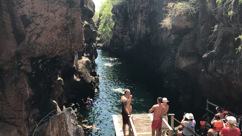
The fissure itself, and the queue for the ladder — it is a popular swim, not a secret one Las Grietas, Santa Cruz · January 2019 -
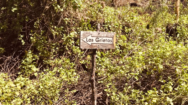
The sign on the trail. From the water taxi it is a walk over lava, not a stroll Trail to Las Grietas, Santa Cruz · January 2019


How you get there
- Water taxi and walk
- A short crossing from the pier in Puerto Ayora to the other side of the bay, then a walk past the salt pans and over lava. The taxi runs on demand and you pay each way.
It sits on Santa Cruz, so how you reach the island decides how you reach this.
What you actually see
The fissure
Two vertical walls of lava with green-blue water between them, and the sky as a strip overhead. It is more dramatic than photographs make it because photographs cannot show how narrow it is.
The layered water
Rainwater sits on top of seawater seeping in from the bay. The boundary is visible when you dive through it, and the temperature changes with it.
The salt pans on the way
The walk passes old salt works. Most people hurry through them; they are part of how people actually lived here.
What goes wrong
We run these trips, so we know what people complain about afterwards. Better to read it here than find out on the day.
- It gets crowded, and the crack is small
- Mid-morning brings everyone at once, and there is not much room. Early or late is a different experience entirely.
- The walk is rougher than expected
- Steps and lava, not a promenade. Flip-flops are a bad idea and people turn ankles here.
- It closes, sometimes without warning
- The site has hours and has been closed for maintenance and for safety work in the past. Check before you pay for the taxi across.
- The water is colder than the beach
- It is enclosed, deep and shaded for much of the day. People get in expecting a warm pool and get out fast.
Who this is not for
Saying this costs us bookings and saves the trip. If any of these is you, tell us and we will build the day differently.
- Non-swimmers. There is no shallow end and nowhere to stand.
- Anyone unsteady on uneven ground — the approach is lava and steps.
- Visitors looking for a beach. This is a rock pool between two walls.
What lives here
- Marine iguana — On the lava along the approach.
- Lava lizard — Everywhere on the walk, and easy to miss.
- Fish in the fissure — Mullet and others move through with the tide.
Nearby
Tortuga Bay
Santa Cruz
What it is →Black Turtle Cove
Santa Cruz
What it is →The Santa Cruz highlands
Santa Cruz
What it is →Las Bachas
Santa Cruz
What it is →Charles Darwin Research Station
Santa Cruz
What it is →El Garrapatero
Santa Cruz
What it is →Every visitor site we have written up → · Santa Cruz, the whole island →
Questions people also ask
Do you need a guide for Las Grietas?
No. You can go on your own. You do need the water taxi across the bay and there are set opening hours.
How deep is the water?
Deep enough that there is nowhere to stand. It is a swim, not a paddle.
Why does the water look strange when you dive?
Fresh rainwater sits above seawater seeping in from the bay. The blur where they meet is a halocline, and swimming through it is the memorable part.
How long does the visit take?
Allow a couple of hours including the crossing and the walk each way. The swim itself is shorter than getting there.
Sources
Every figure on this page comes from one of these. If one of them changes and we have not caught up, tell us and we will fix it the same day.
Planning this trip yourself?
Send us the dates and what you actually want to see. A planner in Cuenca reads it and replies within one business day — not a template, and not a bot.
Plan your trip